
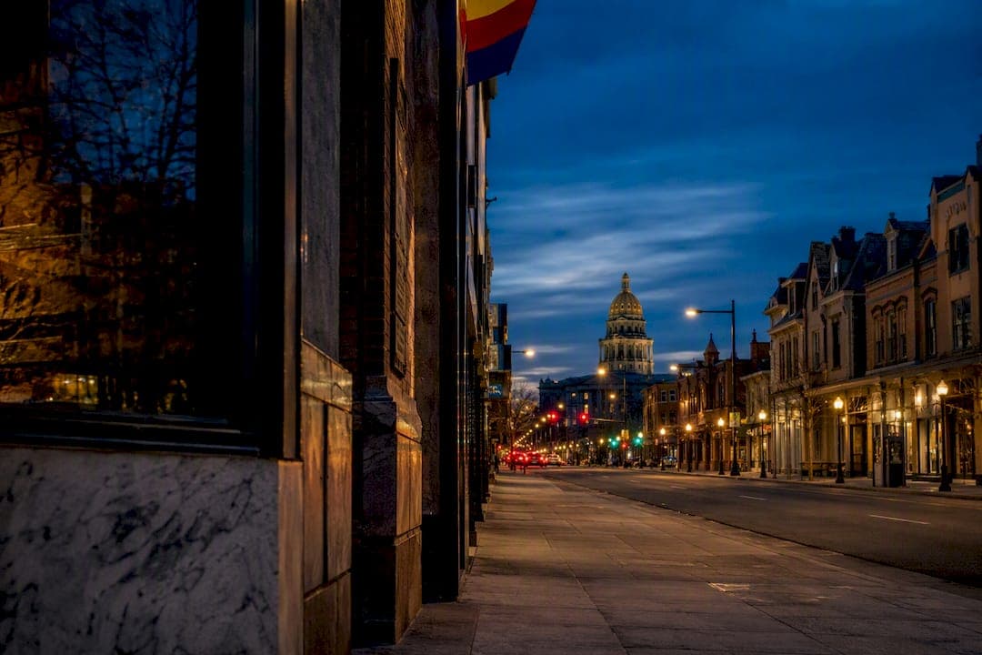
Colfax Avenue is Denver's longest and most historically layered commercial corridor, a route that began as a Gold Rush trail and Indigenous travel path before becoming a Gilded Age address, part of U.S. Route 40, a neon-lit tourist strip, and later a corridor known for decline before its ongoing preservation-driven revival. Its story runs from the 1858 gold rush through statehood politics, streetcar expansion, interstate diversion, and the historic surveys shaping its future today.
TL;DR:
- The corridor's decline accelerated after interstate 70 diverted long-distance traffic away from Colfax in the 1960s, leading to disinvestment and rise in crime.
- Preservation efforts include historic surveys and rezoning initiatives since 2005, aiming to encourage pedestrian-friendly development and transit revival.
- Major landmarks like the Colorado State Capitol, Ogden Theatre, and Casa Bonita reflect the diverse eras of Colfax's evolution from political hub to entertainment strip.
- The nickname "wickedest street" lacks verified origin but persists due to its 1970s and 1980s reputation, maintained in part through historic entertainment venues.
Table of Contents
- A Timeline of Colfax Avenue's History
- Where Did the Name "Colfax" Come From?
- Mansions, Wealth, and the Panic That Changed Everything
- How the Streetcar Turned Colfax Into a Business Corridor
- Why Colfax Became a Neon-Lit Highway Stop
- What Caused Colfax Avenue's Decline?
- What Preservation Efforts Are Reshaping Colfax Today?
- Which Landmarks Define Colfax Avenue's Historic Character?
- How Infrastructure Projects Physically Reshaped the Avenue
- East Colfax vs. West Colfax: Two Different Corridors
- Why Colfax Earned the "Wickedest Street" Nickname
- Notable Events That Shaped Colfax Avenue's Development
- Key Figures Who Shaped Colfax Avenue's History
- What Colfax Avenue's History Teaches Us Today
- Wear a Piece of Colfax's Story
- Where to Learn More About Colfax Avenue's History
- Sources
A Timeline of Colfax Avenue's History
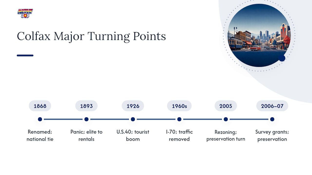
Colfax Avenue's path from wagon trail to preserved corridor spans more than 160 years, and the turning points came fast once Denver started growing. Before any of that, the route followed trade paths used by the Ute and other Indigenous peoples through the South Platte and Cherry Creek valleys, long before Euro-American settlers arrived.
The 1858 Gold Rush turned the corridor into what locals called the "Golden Road," a supply line for prospectors heading toward the mountains. A decade later, in 1868, the street appeared on Denver maps under a new name honoring Vice President Schuyler Colfax, a change tied directly to Colorado's statehood ambitions. By the 1880s and 1890s, Colfax had become one of the city's most fashionable residential addresses, only to see its mansions subdivided after the Panic of 1893 gutted local wealth.
The Denver Tramway's streetcar lines arrived in 1886, and that single infrastructure decision reshaped the avenue for decades. Storefronts sprouted on residential lots, theaters opened near streetcar stops, and Colfax started functioning as a retail spine rather than just a neighborhood street. Then came the highway era: the 1926 designation as U.S. Route 40 turned Colfax into a coast-to-coast motor route, and motels, diners, and neon signs followed the traffic.
Interstate 70 changed everything again in the 1960s, pulling long-haul travelers off Colfax and leaving behind a corridor primed for cheaper land uses. Decline set in through the late 20th century, followed by a preservation and investment push that continues today.
| Era | Approximate Years | Defining Feature |
|---|---|---|
| Indigenous and wagon route | Pre-1858 | Trade paths through the South Platte valley |
| Golden Road | 1858–1868 | Gold Rush supply route |
| Gilded Age residential | 1868–1893 | Mansions, statehood-era renaming |
| Streetcar commercialization | 1886–1920s | Tramway lines, storefronts, theaters |
| U.S. 40 motor era | 1926–1960s | Motels, diners, neon signage |
| Interstate-driven decline | 1960s–1980s | Traffic diversion, disinvestment |
| Preservation and revival | Early 2000s–present | Surveys, rezoning, streetscape investment |
Where Did the Name "Colfax" Come From?
Long before it carried a name at all, the corridor served as a travel route for the Ute and other Indigenous groups moving through the confluence of Cherry Creek and the South Platte River. That geography explains something modern drivers notice immediately: Colfax runs on a diagonal that doesn't match Denver's later grid, because early platting followed the natural drainage lines rather than a compass, according to a history of Denver's street system.
The corridor's first major transformation came with the 1858 Gold Rush, when it functioned as the "Golden Road," a dirt track connecting Denver to the mountain mining camps that drew prospectors west. Wagons, mule trains, and speculators moved along this route toward Central City and Golden before the railroads changed the calculus of mountain travel.
The name "Colfax" appeared on city maps in 1868, honoring Schuyler Colfax, who served as Speaker of the House and later as Vice President under Ulysses Grant. A few facts explain why the renaming happened when it did:
- Colorado boosters were actively lobbying for statehood in the late 1860s.
- Naming a major thoroughfare after a sitting national political figure was a common civic strategy to curry favor.
- The renaming coincided with rapid platting and lot sales along the corridor.
Colorado achieved statehood in 1876, eight years after the renaming, and Colfax Avenue quickly became one of the addresses that signaled the city's ambitions.
Mansions, Wealth, and the Panic That Changed Everything
Colfax Avenue's reputation as an elite residential street peaked in the late 1800s, when Denver's wealthiest citizens built what locals nicknamed "prairie palaces" along its length. Governor Job Cooper and Senator Lawrence Phipps both maintained residences connected to the corridor's early prestige, part of a broader pattern where Colfax evolved into an elite residential district before the century turned.
That prestige didn't survive the economy. The Panic of 1893 wiped out silver-backed fortunes across Colorado, and Denver's real estate market cratered along with it. Owners who couldn't maintain single-family mansions began subdividing them into boarding houses and multi-unit rentals. What had been a street of grand lawns and carriage houses turned, within a decade, into denser housing stock aimed at working- and middle-class tenants.
The Colorado State Capitol's construction anchored the eastern end of the corridor through this transition. Completed in 1901, the gold-domed Capitol gave East Colfax a permanent civic identity even as its residential character eroded. Government workers, lobbyists, and clerks needed housing and services nearby, and the avenue adapted to serve that population instead of the elite families who had built it. The mansion era left physical traces still visible today: the bones of large Victorian-era homes hide behind decades of storefront additions and awkward commercial retrofits, a pattern historians studying the corridor point to as evidence of how quickly Denver's fortunes could turn.
How the Streetcar Turned Colfax Into a Business Corridor
The Denver Tramway Company extended streetcar service along Colfax starting in 1886, and that decision did more to shape the avenue's commercial future than almost anything else in its history. Streetcars meant foot traffic, and foot traffic meant retail.
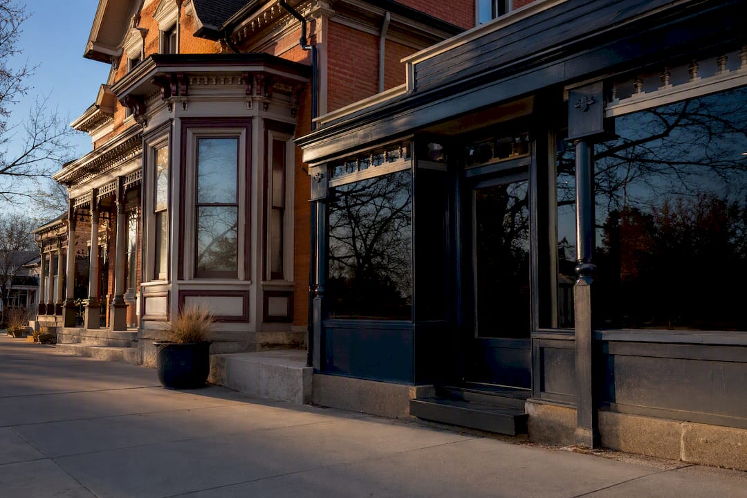
Property owners responded by grafting storefronts onto existing houses, turning front parlors into shops and adding display windows to what had been residential facades. This piecemeal commercialization gives East Colfax its architectural texture today: buildings that still show their Victorian bones underneath decades of retrofitted storefronts.
Entertainment followed the transit lines closely. Early theaters opened near streetcar stops to capture riders heading downtown or home, establishing a pattern of live entertainment venues along the corridor that persisted for generations. This era set the template that later decades would build on: transit access dictates commercial density, and commercial density dictates what kind of businesses can survive on a given block.
Why Colfax Became a Neon-Lit Highway Stop
Colfax's designation as part of U.S. Route 40 in 1926 turned it into a national highway corridor, and the transformation was immediate and visible. Cross-country drivers needed places to sleep, eat, and refuel, and Colfax delivered all three in a strip of motels, diners, and roadside attractions lit up with neon.
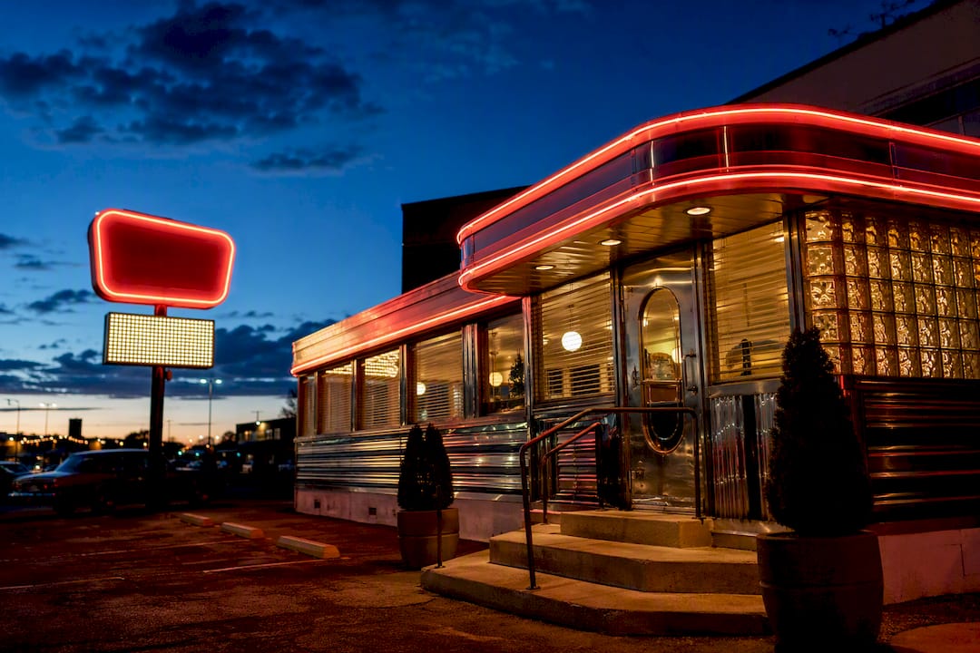
The motor-tourism boom reshaped land use along the entire corridor. Motels replaced older buildings or filled vacant lots, drive-in restaurants catered to car culture, and business owners competed for attention with increasingly elaborate signage. Davies Chuck Wagon Diner, which relocated to its current spot in 1957, survives today as one of the clearest physical reminders of that motor-era culture, neon horse and all.
History Colorado's exhibit documenting this period, titled "Forty Years on the 'Fax," captures how thoroughly the highway designation reoriented the avenue's economy around automobile travelers rather than local residents or streetcar riders. Tourist courts and family-run motels lined blocks that a generation earlier had held Victorian mansions. Land values followed traffic patterns, not architecture or history, and that shift set up the next major disruption: the interstate system that would eventually pull that same traffic away.
What Caused Colfax Avenue's Decline?
Interstate 70's construction diverted long-distance traffic away from Colfax starting in the 1960s, and the effect on the avenue's motel and diner economy was immediate. Sixth Avenue absorbed additional through traffic as well, leaving Colfax without the steady stream of highway travelers that had sustained its businesses for decades.
Zoning decisions compounded the traffic loss. A permissive 1925 zoning framework had already allowed a wide mix of commercial uses to cluster along the corridor, and as legitimate tourist traffic dried up, that same flexibility let adult businesses, pawn shops, and cheap motels move into vacancies left behind. Motels built for road-tripping families increasingly rented rooms by the week or the hour.
Crime rates climbed through the 1970s and 1980s, and Colfax picked up a reputation that outlasted the specific conditions that created it. This is where the "wickedest street in America" label took hold, an era that left a lasting mark on how outsiders perceived the corridor even decades later.
What Preservation Efforts Are Reshaping Colfax Today?
History Colorado funded historic survey grants in 2006 and 2007 that documented East Colfax's building stock, cataloging Victorian-era structures hidden behind decades of commercial retrofitting. That East Colfax historic building survey gave preservationists and city planners a factual baseline for decisions that followed.
Denver rezoned targeted stretches of Colfax to Main Street designations in 2005, a change intended to encourage pedestrian-friendly infill development rather than auto-oriented sprawl. Streetscape investments followed, funding new sidewalks, lighting, and public space improvements meant to make the corridor walkable again.
Planning for East Colfax Bus Rapid Transit continues, a project designed to restore the kind of transit-driven density the avenue had during its streetcar era. Recent planning documents suggest city officials are deliberately tying transit upgrades to preservation goals, an approach meant to avoid repeating the disinvestment cycle that followed the interstate era. Whether that balance holds as new development pressure builds is the open question shaping Colfax's next chapter.
Which Landmarks Define Colfax Avenue's Historic Character?
A handful of sites anchor Colfax's identity for anyone walking or driving the corridor today, each representing a different era of the avenue's evolution:
- Colorado State Capitol: Completed in 1901, its gold dome anchors East Colfax and gave the corridor permanent civic weight even as its residential character faded.
- United States Mint (Denver Mint): Positioned near the Capitol district, the Mint's early 20th-century presence reinforced East Colfax's role as a government and institutional corridor.
- Ogden Theatre: Opened in 1919 as a movie palace, it survives as a live music venue and one of the clearest links to Colfax's early entertainment era.
- Bluebird Theater: Another early 20th-century venue turned music hall, it represents the corridor's long-running identity as an entertainment strip.
- Casa Bonita: The pink-towered Mexican restaurant and entertainment complex became a cultural touchstone for generations of Denver kids, part of the mid-century roadside attraction pattern.
- Davies Chuck Wagon Diner: Relocated to its current site in 1957, its neon horse sign remains one of the most recognizable surviving artifacts of the U.S. 40 motor era.
Architecturally, Colfax reads like a cross-section of Denver's history. Converted mansions from the 1880s sit near early-1900s flats, and motor-era neon signage from the 1920s through 1950s still punctuates blocks that otherwise show little continuity in building style. That inconsistency isn't a flaw. It's the record of every era the corridor has passed through.
How Infrastructure Projects Physically Reshaped the Avenue
Colfax was paved by 1916, and the Colfax Viaduct followed in 1917, both projects that supported the growing volume of automobile and streetcar traffic moving through the corridor. Nearly two decades later, the Civilian Conservation Corps widened West Colfax between 1935 and 1936 as part of a broader New Deal infrastructure push, a project that permanently altered the street's width and traffic capacity on that side of town.
Streetcar service ended by 1950, replaced by buses that offered more route flexibility but lost the fixed-rail permanence that had encouraged dense storefront investment near stops. Federal highway policy delivered the next blow: interstate construction diverted long-distance traffic away from the surface street entirely, a shift documented in analysis of Colfax's historical trajectory. Each infrastructure decision, one century's paving project or the next century's freeway, changed who used the avenue and what kind of business could survive along it.
East Colfax vs. West Colfax: Two Different Corridors
East and West Colfax developed along genuinely different paths despite sharing a single street name. East Colfax, anchored by the State Capitol district, grew into a center of government activity, entertainment venues, and institutional presence, reflecting its early status as Denver's political and civic address.
West Colfax followed a different trajectory shaped by successive waves of immigration. The neighborhood developed a multiethnic, working-class character that stood in contrast to East Colfax's institutional identity, with Jewish, Latino, and other immigrant communities shaping the area's businesses and social fabric over decades. That demographic contrast still shows up today in the kinds of restaurants, shops, and cultural institutions that cluster on each end of the avenue, a living reminder that "Colfax" was never one neighborhood's story but several running in parallel.
Why Colfax Earned the "Wickedest Street" Nickname
Colfax's reputation as America's "longest, wickedest street" is one of Denver's most repeated pieces of local folklore, but the origin story most people cite doesn't hold up well. The popular version credits Playboy founder Hugh Hefner with coining the label, but that Playboy connection is unverified despite decades of repetition in local media and tourist guides. Folklore solidified the nickname regardless of whether the original source checks out, and it stuck because the corridor's 1970s and 1980s reputation gave it a ring of truth.
Music and entertainment culture kept Colfax culturally relevant even through its roughest decades. The Ogden Theatre and Bluebird Theater hosted touring and local acts that gave the avenue a reputation for live music distinct from its vice-district image. Civic rituals have reinforced that ongoing attachment: the annual Colfax Marathon draws runners along the full length of the corridor, treating the avenue itself as the event's identity rather than just its route.
Notable Events That Shaped Colfax Avenue's Development
Several specific moments pushed Colfax from one era into the next rather than letting it drift gradually. The 1868 renaming and mapping of the street marked its first formal identity shift, tying the corridor's name to national politics rather than local geography.
The Panic of 1893 stands as the clearest economic shock in the avenue's history, converting an elite residential street into subdivided rental housing within a matter of years. The 1926 U.S. 40 designation triggered the opposite kind of change, a boom rather than a bust, flooding the corridor with tourist dollars and motel construction for four decades.
Interstate 70's construction in the 1960s functioned as a second economic shock, this time removing rather than adding traffic, and its effects compounded through the following two decades of disinvestment. The 2005 Main Street rezoning and the 2006 to 2007 History Colorado survey grants mark the most recent turning point, shifting Colfax from a corridor defined by decline toward one actively managed for preservation. Each of these moments reflects the same underlying pattern: Colfax changes fastest when a single policy decision, whether a political renaming, a financial panic, a highway designation, or a zoning change, reshapes who has a reason to be on the street.
Key Figures Who Shaped Colfax Avenue's History
Colfax's evolution owes as much to political namesakes and civic decision-makers as to the business owners who built along its length. Schuyler Colfax himself never lived in Denver, but his political stature made him a useful namesake for a city angling toward statehood in 1868, and that naming decision outlasted his own political career by more than a century.
Governor Job Cooper and Senator Lawrence Phipps represent the wealthy residents whose mansions defined the avenue's Gilded Age reputation, even though their personal fortunes and the Panic of 1893 that followed tell a story bigger than either individual. Denver Tramway Company executives, though less individually remembered, made the 1886 streetcar decision that shaped the avenue's commercial pattern for the next 60 years.
More recently, the preservationists and city planners behind the East Colfax historic building survey and the 2005 Main Street rezoning have functioned as the corridor's modern shapers, working through institutions like History Colorado rather than individual name recognition. Their influence is less visible than a governor's mansion or a Vice President's name on a map, but their survey work and zoning decisions are what determine whether Colfax's next fifty years look like preservation or another cycle of disinvestment.
What Colfax Avenue's History Teaches Us Today
Colfax doesn't fit the story Denver likes to tell about itself, and that's exactly why it matters. Native303apparel builds designs around places like this because the honest version of local history, mansions turned into boarding houses, highway glamour turned into decline, decline turned into slow preservation, says more about a city than any polished tourism narrative ever could.
Respecting that layered history means resisting the urge to sand it down into either nostalgia or cautionary tale. Colfax was never just one thing, and pretending otherwise flattens what actually makes it worth remembering.
If the avenue's history means something to you, there are concrete ways to engage beyond reading about it. Dig into the Denver Public Library's Western History collections, support ongoing historic survey work, or simply show up to neighborhood events along the corridor. History that stays alive is history people keep showing up for.
— Rob
Wear a Piece of Colfax's Story
Some apparel designers turn Colfax's decades of neon signs, diner counters, and theater marquees into apparel you can actually wear, not a museum placard but a shirt that starts a conversation with anyone who grew up on this street or wishes they had.

Every design draws from the same layered history covered here: the Ogden Theatre's marquee, the ghost signs of long-gone motels, the diner culture that once defined the U.S. 40 stretch. Browse the current lineup at the Native303apparel storefront, and if you have a specific Colfax memory in mind, whether it's a particular venue, a defunct shop, or a landmark from your own family's history in Denver, the design request page lets you commission a piece built around it. Check the size guide before you order, then go pick out the piece of Colfax you want to carry with you.
Where to Learn More About Colfax Avenue's History
For readers who want to go deeper, the Denver Public Library's Western History Collections hold primary documents and photographs covering the corridor's development. History Colorado's exhibit archives and reports, including materials tied to the "Forty Years on the 'Fax" exhibit, offer institutional documentation of the avenue's mid-century tourist era and its preservation history.
Sources
- East Colfax Avenue
- Colfax: Metro Denver’s Most Famous (or Infamous!) Street – Colorado Virtual Library
- Colfaxavenue
- Forty Years on the 'Fax - History Colorado
- Colfax Avenue: The Soul of Denver's Longest, Wildest Street - Denvers Best